The Warm Pool Variability of the Tropical Northeast Pacific and its Relation to the Atlantic Warm Pool
Danielle
Groenen
Center for Ocean-Atmospheric Prediction Studies, Florida State University
Poster
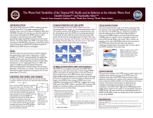
The warm pool in the tropical northeast Pacific Ocean (WNEP), defined by the area enclosed by the 28.5°C isotherm, is examined for its seasonal cycle and interannual variability. The study characterizes the WNEP by its area and objectively defined onset, demise, and length of the WNEP season. The onset of the WNEP season is defined by the day when the daily anomaly of the area of WNEP exceeds the climatological annual mean WNEP area. Similarly, the demise of the WNEP season is defined when the daily anomaly of the area of the WNEP falls below the climatological annual mean WNEP area after the onset date is detected. We show that the seasonal evolution of the WNEP has a strong asymmetry, with the climatological peak of the WNEP area occurring approximately 41 days from the onset while the demise of the season occurs after nearly 106 days from the climatological peak.
The WNEP is part of a larger western hemisphere warm pool (WHWP) that extends into the Intra-Americas Seas and parts of the tropical northwest Atlantic Ocean. This study finds that the WNEP is weakly related to the Atlantic counterpart of the WHWP. This is partly due to the fact that the WNEP season precedes the seasonal peak of the warm pool in the Atlantic by several months and the size of the former is much smaller than the latter; therefore the WNEP does not have a strong remote forcing on the Atlantic warm pool.
The WNEP is part of a larger western hemisphere warm pool (WHWP) that extends into the Intra-Americas Seas and parts of the tropical northwest Atlantic Ocean. This study finds that the WNEP is weakly related to the Atlantic counterpart of the WHWP. This is partly due to the fact that the WNEP season precedes the seasonal peak of the warm pool in the Atlantic by several months and the size of the former is much smaller than the latter; therefore the WNEP does not have a strong remote forcing on the Atlantic warm pool.

Poster 11.pdf
(1.65 MB)
Session II: Ocean-Land-Atmosphere interactions of the Continental Americas and the Caribbean

Number of comments: 6
Comments
Comment by: Chunzai Wang
September 4, 2015 - 11:19am
Hi Dan:
Thank you for working on this topic. Our early work includes the discussion of the EPWP and AWP (Wang et al. 2006, JC).
Chunzai
Comment by: Danielle Groenen
September 4, 2015 - 11:27am
Hi Chunzai,
Thank you for your comments. Yes, I will look more closely into the paper you mentioned.
Thank you,
Danielle
Comment by: Ivonne García
September 7, 2015 - 8:53pm
Hi Danielle,
Very interesting work. I am also interested in understanding the relationship between the EPWP and the precipitation. I would like to ask you a few things:
1) How do you interpret the sign of correlations in Fig. 3? Because what I see is that an early (late) onset of the EPWP is associated with less (LESS) AMJ rainfall over Southeastern Mexico and Southwestern US. Am I missing something?
2) Do you have any idea what physical mechanism may explain this onset EPWP-AMJ rainfall relationship?
3) Have you done correlations with the extension (area) of the EPWP (instead of the onset) to see if there is a relationship with rainfall?
Comment by: Danielle Groenen
September 10, 2015 - 12:55pm
Hi Ivonne,
Thank you for your comments. In response to your questions:
1) Positive correlations mean an early onset of EPWP will lead to more rainfall and negative correlations means an early onset will lead to less rainfall. Therefore, with an early onset of EPWP, there will be more rainfall in SE Mexico and SW US, and less rainfall along the Pacific Coast and Ohio Valley.
2) My guess is that with an early onset of EPWP, there will be a greater temperature gradient between the Pacific and Atlantic Ocean sides. This temperature gradient will cause increased easterly winds and increase the amount of moisture coming into the area. It rains more the on the eastern side because of it is the windward side of the mountains.
3) No, I haven't but that is an excellent idea. I suspect there is a relationship between rainfall and area of EPWP.
Comment by: Chunzai Wang
September 10, 2015 - 1:18pm
Ivonne, see Wang et al. (2006, JC).
Comment by: Vasu Misra
September 10, 2015 - 1:01pm
This is in response to Ivonne's questions:
1) Yes your interpretation is indeed correct. Fig. 3 suggests that early (late) onset of the EPWP is likely to be associated with less (more) AMJ rainfall over Southeastern Mexico and Southwestern US (Pacific Northwest US and over Ohio valley)
2) We have explained this teleconnection from the 500hPa height anomalies (rossby wave response) to ENSO forcing from the deep tropics. So we have modulation of the North Pacific High and modulation of low level easterlies.
3) Yes and we get similar patterns, albeit a bit stronger. So we are advocating that monitoring of the onset of the EPWP has some value to anticipate the forthcoming season.
Not accepting new comments