Extreme Weather Events over Hawaii and Western United Stated in February 2019 Linked to Persistent Ridging over the North Pacific
Tyler
Leicht
University at Albany, SUNY
Poster
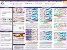
A highly amplified upper-level flow pattern over the central and eastern North Pacific basin and western North America during February 2019 was associated with several high impact weather events in Hawaii and the southwestern United States. Persistent Kona Low conditions lowered snow levels and produced chilly conditions in Hawaii, while frequent trough passages over western North America resulted in multiple rounds of high-impact precipitation events over the southwestern United States spanning around three weeks. This presentation will show how these high-impact weather events are linked to a blocking high in the Gulf of Alaska, a persistent time-mean upper-level trough near the east coast of Asia, a retracted western Pacific subtropical jet stream (STJ), cyclonic wave breaking (CWB) in the exit region of this STJ, and downstream troughing over western North America.
Periodic CWB events over the west-central Pacific between 1–10 February precluded the STJ from extending eastward across the Dateline toward North America. This retracted jet allowed for the formation and maintenance of a persistent ridge from 6–15 February in the Gulf of Alaska. This persistent ridge was enhanced due to several episodes of CWB near the Dateline, leading to two episodes of discontinuous ridge retrogression (DRR), a process by which a new ridge is amplified just upstream of the original ridge. The first round of DRR on 8–9 February built the ridge further west toward the Aleutians and lead to the formation of a cutoff cyclone northeast of Hawaii due to anticyclonic wave breaking (AWB). A second CWB event from 12–13 February resulted in further westward shifting of the persistent ridge over western Alaska on 14–15 February. Strong northerly flow east of this anticyclone throughout the lifecycle of the persistent ridge drove cold air southward across western North America and contributed to record snowfalls in Flagstaff, AZ. By 21 February, the persistent ridge had taken on more of an omega block structure. Positively-tilted troughs on the eastern flank of the omega block led to two separate extreme precipitation events by the end of the month, with The goal of this work is to utilize the framework of a case study over an entire month to highlight the potential for linked EWEs during extended blocking patterns, and to demonstrate that the configuration of the upstream blocking anticyclone will govern the structure and evolution of downstream EWEs.
Periodic CWB events over the west-central Pacific between 1–10 February precluded the STJ from extending eastward across the Dateline toward North America. This retracted jet allowed for the formation and maintenance of a persistent ridge from 6–15 February in the Gulf of Alaska. This persistent ridge was enhanced due to several episodes of CWB near the Dateline, leading to two episodes of discontinuous ridge retrogression (DRR), a process by which a new ridge is amplified just upstream of the original ridge. The first round of DRR on 8–9 February built the ridge further west toward the Aleutians and lead to the formation of a cutoff cyclone northeast of Hawaii due to anticyclonic wave breaking (AWB). A second CWB event from 12–13 February resulted in further westward shifting of the persistent ridge over western Alaska on 14–15 February. Strong northerly flow east of this anticyclone throughout the lifecycle of the persistent ridge drove cold air southward across western North America and contributed to record snowfalls in Flagstaff, AZ. By 21 February, the persistent ridge had taken on more of an omega block structure. Positively-tilted troughs on the eastern flank of the omega block led to two separate extreme precipitation events by the end of the month, with The goal of this work is to utilize the framework of a case study over an entire month to highlight the potential for linked EWEs during extended blocking patterns, and to demonstrate that the configuration of the upstream blocking anticyclone will govern the structure and evolution of downstream EWEs.

Poster file
Leicht_Tyler_Blocking_Poster.pdf
(8.21 MB)
Meeting homepage
