Shoreline Monitoring Using a Network of Webcams
Mona
Zhao
University of California, Santa Cruz
Poster
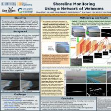
Ocean observing network of webcams such as those managed by webcoos.org and NWLON, those sponsored by USGS (e.g. https://www.usgs.gov/centers/pcmsc/science/using-video-imagery-study-coastal-change-santa-cruz-beaches#overview), and others (e.g. beach resorts) provide a great resource for monitoring our shorelines. In contrast to calculating brightest pixel images to determine extent of beach runups, we investigate the use of machine learning methods for shoreline extraction. This approach opens up the potential to analyze shoreline changes at different timescales, from swash zone dynamics to seasonal events to even longer scales. Machine learning methods rely on a high quality training data set for accurate inference. Various factors affect the appearance of shorelines ranging from seasonal changes (e.g. more stormy, foggy, or even snow), time of day (e.g. different lighting such as glare, or tidal changes), lens condition (e.g. dirt or moisture on the lens). All these lead to different conditions e.g. beach scene with fog taken from a lens with smudge. We propose a systematic approach of creating a training data set optimized for each beach based on the distribution of various combinations that represents each locale. We share
some preliminary results obtained to date.
some preliminary results obtained to date.

Poster file
zhao-optimizing-poster.pdf
(4.3 MB)
