Pilot Upgrade of NOAA NDBC Coastal Weather Buoys for Improved Monitoring of Weather and Climate
Yolande
Serra
University of Washington Cooperative Institute for Climate, Ocean and Ecosystem Studies (CICOES)
Poster
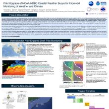
The main objective of this proposal is to design a prototype operational NDBC Coastal Weather Buoy (CWB) that measures collocated subsurface and surface variables in real-time and provides post-deployment quality controlled data capable of characterizing air-sea interaction and subsurface ocean heat content and mixed layer variability in the Gulf Stream extension region. Current NDBC CWBs observe air temperature, dew point, sea surface temperature (SST), wind speed and direction, surface pressure, and wave height, period, and direction. The proposed additional measurement capabilities include longwave and shortwave radiation, surface currents and salinity, and subsurface profiles of temperature, salinity and currents. The expected outputs from this project are: (1) a transition from Readiness Level (RL) 6 (demonstration of prototype) to RL 8 (finalization) for an all-in-one operational CWB capable of reporting full air- sea heat and momentum fluxes, wave properties, and ocean current, temperature and salinity profiles that can be adopted to upgrade NDBC’s CWB network; (2) real-time and post-processed quality controlled data and their real time display and delivery from the upgraded CWB; and (3) manuscripts describing the prototype mooring capability and the importance of collocated air-sea flux and ocean mixed layer observations in understanding and predicting coupled physics in weather and climate variability. This project involves substantial collaboration with NOAA research (PMEL) and operations (NDBC). NDBC manages the deployment, operations, and maintenance of the national buoy networks and is the anticipated primary end user of the new CWB prototype. The National Weather Service and national and international modeling centers are the anticipated primary end users of the proposed new data products. Additionally, these co- located air-sea measurements will be useful for verifying satellite retrievals near the U.S. coastline and the next generation of coupled assimilative models; and for research to improve long-term forecasts that depend upon the ocean influence on weather and climate.

Poster file
serra-yolande-poster.pdf
(4.29 MB)
