CDIP Observations of Coastal Wave Conditions and Climate
James
Behrens
Scripps Institution of Oceanography, UC San Diego
Poster
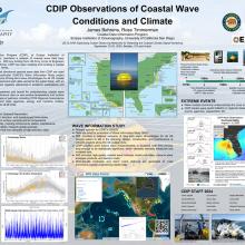
The Coastal Data Information Program (CDIP), at Scripps Institution of Oceanography, UC San Diego, maintains a network of moored wave data buoy stations in US waters worldwide. With key funding from US Army Corps of Engineers and the State of California, CDIP has been creating and curating a coastal wave climate data set since the 1970s. High precision, quality controlled directional spectral wave data from CDIP are used to validate global models, in particular USACE's Wave Information Study project which provides a national resource of long-term wave climatologies for all U.S. coastal waters. The spectra, plus displacement path data, served to the public with an emphasis on high availability, are regularly referenced in academic publications and technical reports worldwide. CDIP stations are providing baselines and trends for understanding coastal wave climate, plus valuable in situ reference data on sea surface temperature and surface currents.

Poster file
Behrens-James-poster.pdf
(6.97 MB)
