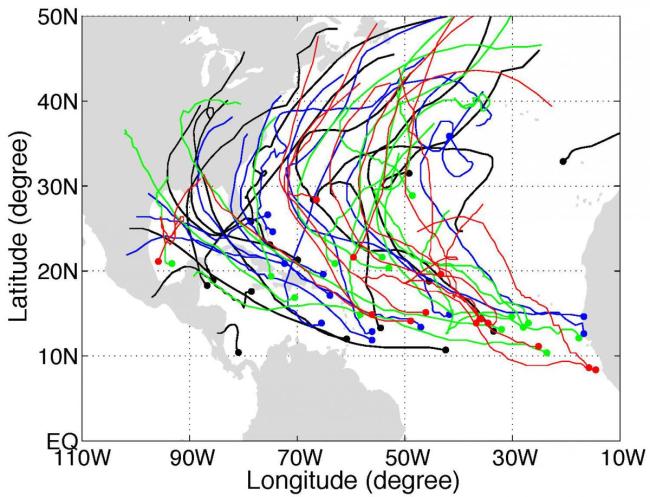
Predictability of North Atlantic tropical cyclone track density
Tropical cyclones are among the most devastating storms on Earth. Tropical cyclone activity in the North Atlantic displays large interannual variability in both number and track density. Recent studies show that global high-resolution models have remarkable skill in simulating the interannual variability in cyclone counts, implicating strong control by sea surface temperatures patterns. This study analyzes an ensemble simulation by the GFDL High Resolution Atmospheric Model, with each member differing only in initial conditions. While previous studies focus on ensemble mean variability due to sea surface temperature forcing, this study examines atmospheric internal variability that affects cyclone track distributions.

The analysis of the ensemble mean shows that cyclone track density is influenced by changes in local and remote sea surface temperatures. For example, an anomalous sea surface warming over the tropical North Atlantic is favorable for more frequent cyclone passages over most of the basin. The sea surface temperature-forced track density also exhibits inter-basin oscillations. For instance, when cyclones are anomalously active over the Gulf of Mexico, the US East Coast and the open ocean to the east most likely experience a quiet hurricane season. In contrast to strong sea surface temperature control on basin counts, unpredictable internal variability in track density is strong over the Gulf Coast and US East Coast - indicating that prediction of regional cyclone activity, especially landfall hurricanes, is challenging.
Variability of Tropical Cyclone Track Density in the North Atlantic: Observations and High-Resolution Simulations (Journal of Climate)
1Scripps Institution of Oceanography
2NOAA Geophysical Fluid Dynamics Laboratory
3University Corporation for Atmospheric Research
Topics
- Hurricane
- Extreme Events
